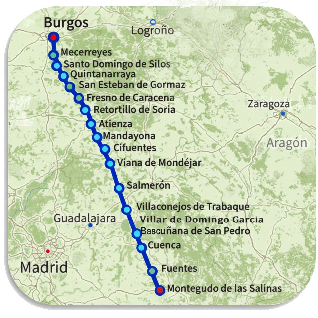
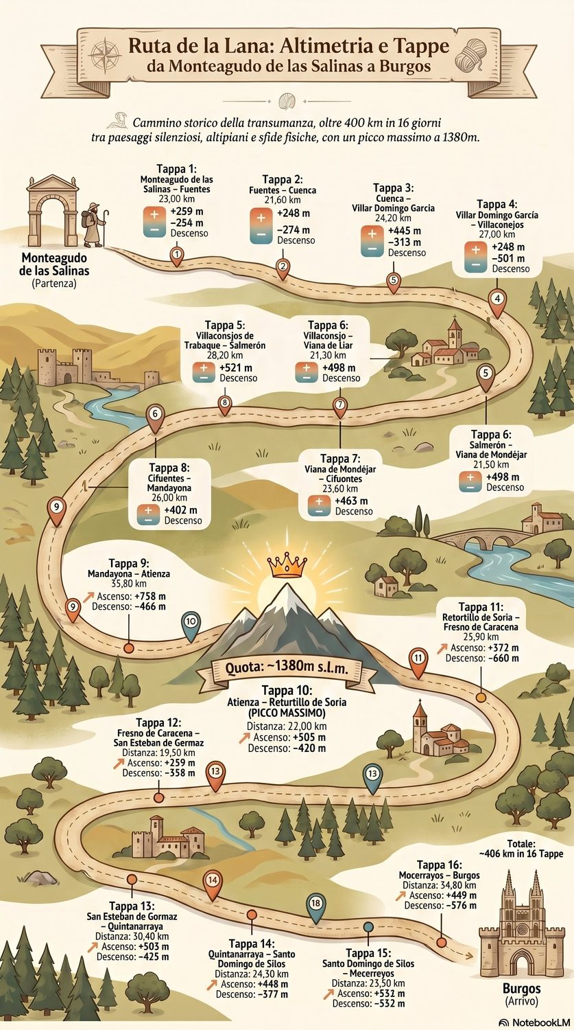
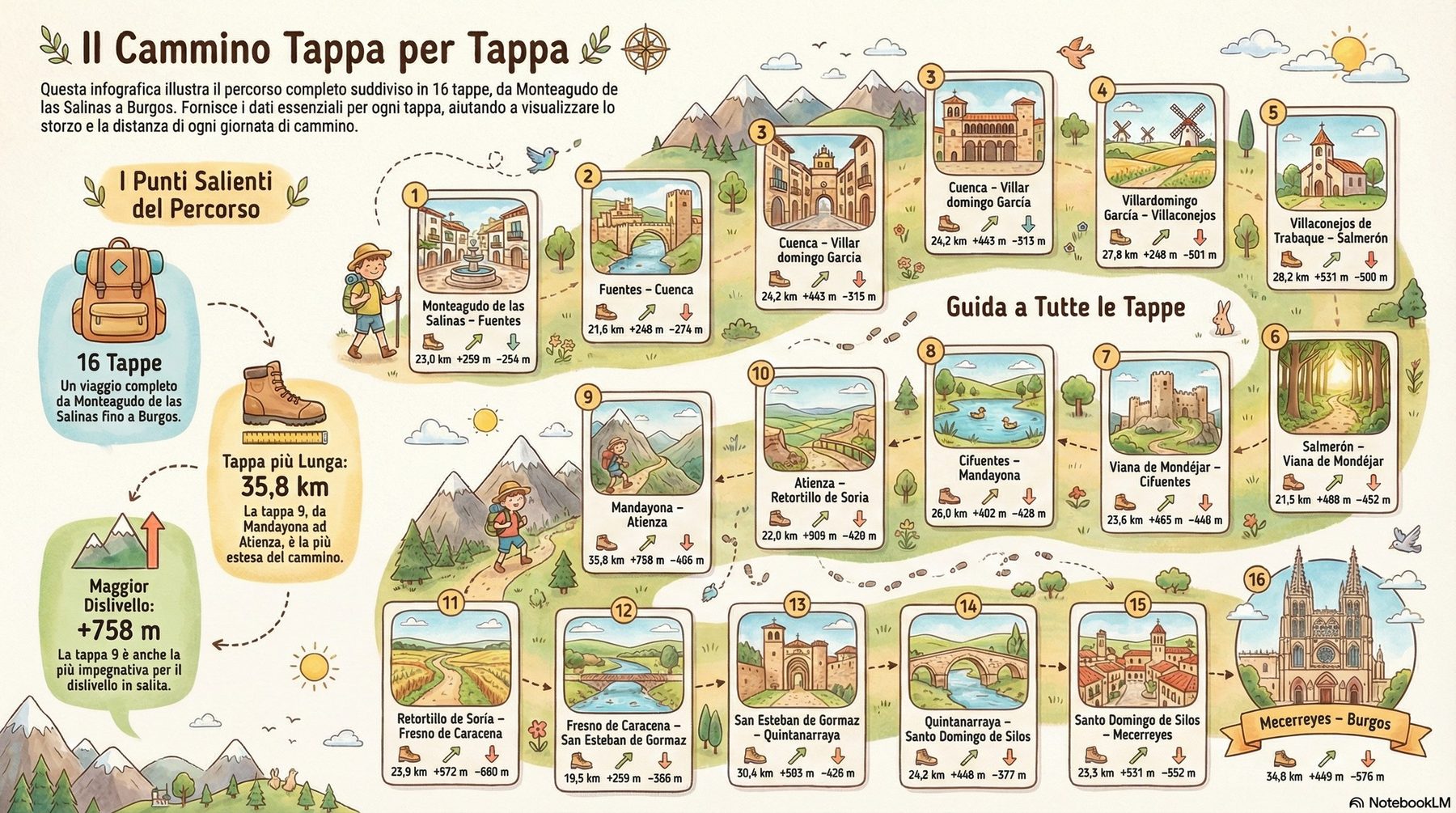
01Monteagudo de las Salinas → Fuentes23.0 km · 3/5
02Fuentes → Cuencathe hanging city above two gorges21.6 km · 3/5
03Cuenca → Villar de Domingo Garcíavia Bascuñana de San Pedro28.5 km · 3/5
04Villar de Domingo García → Villaconejos de Trabaque22.9 km · 2/5
05Villaconejos de Trabaque → Salmerón28.2 km · 3/5
06Salmerón → Viana de Mondéjar22.6 km · 3/5
07Viana de Mondéjar → CifuentesTrillo, the río, the bullring shelter23.6 km · 3/5
08Cifuentes → Mandayona26.0 km · 3/5
09Mandayona → Sigüenzathe castle-Parador arrival23.1 km · 3/5
10Sigüenza → Atienzathe toughest day31.4 km · 4/5
11Atienza → Retortillo de Soriahighest point, 1,372 m22.0 km · 3/5
12Retortillo de Soria → Fresno de Caracenathe Caracena canyon & castle23.9 km · 3/5
13Fresno de Caracena → San Esteban de Gormaz19.5 km · 2/5
14San Esteban de Gormaz → Quintanarraya30.4 km · 4/5
15Quintanarraya → Santo Domingo de Silosthe great Benedictine monastery~24 km · 3/5
16Santo Domingo de Silos → Mecerreyes23.5 km · 3/5
17Mecerreyes → Burgosinto the Camino Francés34.8 km · 4/5
Distances are indicative, drawn from the guide. Always call shelters one or two days ahead.